Shopping Cart
0 item(s) - 0.00€Skytraxx 2.0
Ex Tax: 360.00€
Add to Compare
Brief description
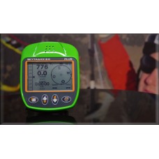
The new SKYTRAXX 2.0 is further development from the SKYTRAXX first generation.
The Vario with high precision sensor system is very easy to use, the altitude sensors have a resolution of 5 cm. The altimeter is barometric calibrated over GPS up to 9999 meter. The Vario has a very sensitive reaction time below 1 second. The Vario value will be prompted and averaged 50 times per second. It's a compact instrument with integrated GPS and Logger. Ideal for using in DHV-OLC.
32 Bit Risc Microcontroller.
4 GigaByte Memory.
Battery running time approx. 35-40 hours.
Thermikdisplay.
User defined Screen.
USB Interface.
No extern Software necessary.
Languages: Deu, Eng, Fra, Ned, Pol, Spa, Ita, Rum.
Windows, Linux und MAC compatible.
M4 threaded cover for many attachments.
Display options
Altitude Absolut, Altitude Relativ, Altitude kumulated. All values in Meter or Feet.
AGL Height over Ground.
Vario digital
Glideratio
Speed over ground
Winddirection and windspeed
Last thermal and distance with intensity
Flightdirection
Battery status
GPS status
Flighttime, Time
Coordinate in different formats
Temperature in °C or Fahrenheit
QNH Pressure
Flightlevel
Distance to Waypoint, needed Glideratio to target
Distance to next Airspace
Battery level
Firmwareupdate without any Software
Technic Datas
Varioscreen digital ±30 m/s.
Varioscreen analog ±4 m/s.
500000 Waypoints
500000 Airspaces
10000 hours Flightmemory (Intervall 1 second).
Akku LI-ION 2600 mAh. Runtime 40 hours.
Integrated Charger.
66 Channell GPS-Modul. Updaterate up to 10 times per second.
Dimension (L x B x H) 120mm x 98mm x 25mm.
Weight 185 Gramm.
Write a review
Your Name:Your Review: Note: HTML is not translated!
Rating: Bad Good
Enter the code in the box below:
XC Academy Shop © 2025


